Lightning Ridge Opal Fields
a little history
The township of Lightning Ridge NSW, originally named Wallangulla, is located 750 kilometres North West of Sydney and just off the Castlereagh Highway in the Counties of Finch and Narran. Opal is reported as first being mined by a boundary rider named Jack Murray in 1901, though it is described in the literature that Opal may have been known before this time. In 1902, Nettleton sent a parcel of Lightning Ridge Black opal to Edmund Murphy and Tully Wollaston in White Cliffs for sale. Since that time, Lightning Ridge Black opal has gained the reputation of the best Black Opal in the world. Outer lying fields of Coocoran, Glengarry, and Sheepyard have enhanced the opal mining areas in this district.

Cover of biographical discussion of Katie Parker.

The cover of the most up-to-date history of Lightning Ridge.

A bronze statue of Charlie Nettleton outside the Lightning Ridge Historical Society.

Nettleton’s First Shaft monument at the Six Mile field Lightning ridge.

A close up of the Monument plaque.

An old historical photograph from the Sherman Archives of the opal filed named “The leaning tree”, and example of how opal fields have been named.

A historical photo provided to the Opal Academy by Cameron Marks of early days in Lightning Ridge. An aboriginal camp Circa 1906.
geography and mining fields
The road to Lightning Ridge is the Castlereagh Highway, for much of its journey from central NSW, the road follows the Castlereagh River which flows in a northerly direction to intersect with the Darling river which forms a part of what is known as the Murray Darling Basin. it passes through the agricultural areas and townships of Gilgandra, Coonamble and Walgett. The opal mining district around Lightning Ridge is a roughly triangular region bounded by the Barwon River on the east, the Narran river on the west and the Queensland border to the north.

A photograph of what was named the “Christmas Tree” pointing to various fields in the Coocoran opal fields Lightning Ridge
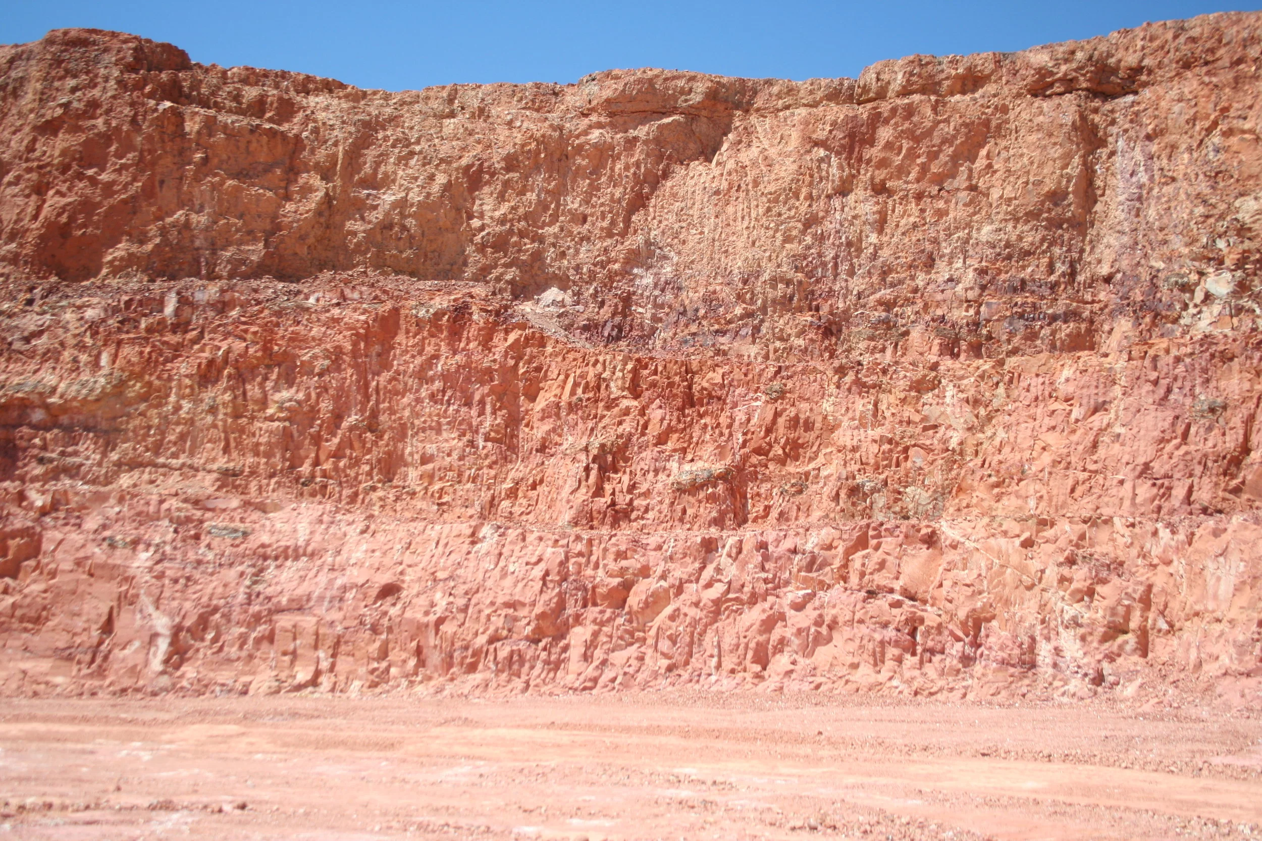
The area is within the Western Plains of NSW, a series of black soil plains consisting of recent alluvium which are extensive in the region. The black soil plains are broken by low ridges and hills which rise to a maximum of 30m (100 ft) and are considered to be of Cretaceous age (66-145 million years ago (Ma))
The original opal fields in Lightning Ridge are now encompassed with in the “town area”. Named opal fields such as “The Three Mile” for example give an idea to the opal field areas. Field names are assigned in a colloquial fashion, named after distance, geography, vegetation for example “the Leaning Tree”, or the hopes of the miners “Lunatic Hill”.
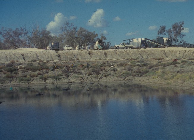
As opal mining progressed in the ‘Ridge’, more prospective ground was found with exploration. This resulted in the discovery of the Coocoran opal fields on the western edge of a perennial lake (Coocoran Lake) to the west of the Lightning Ridge district. Although there was some mining in this area in the mid 1980’s, it was exacerbated by an event known as “Allah’s Rush”. During this time much of the opal mining moved into this new area of production.
Editors note: The Lightning Ridge “district” in some ways is a generalisation of the opal fields in this part of NSW. There are some discrete opal fileds in outerlying areas of the district that deserve mention. In particular the are the mining fields ot ‘The Grawin”, Glengarry, and “The Sheepyards”. In due time we will post information on these fields .
a little geology
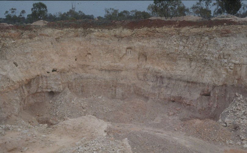
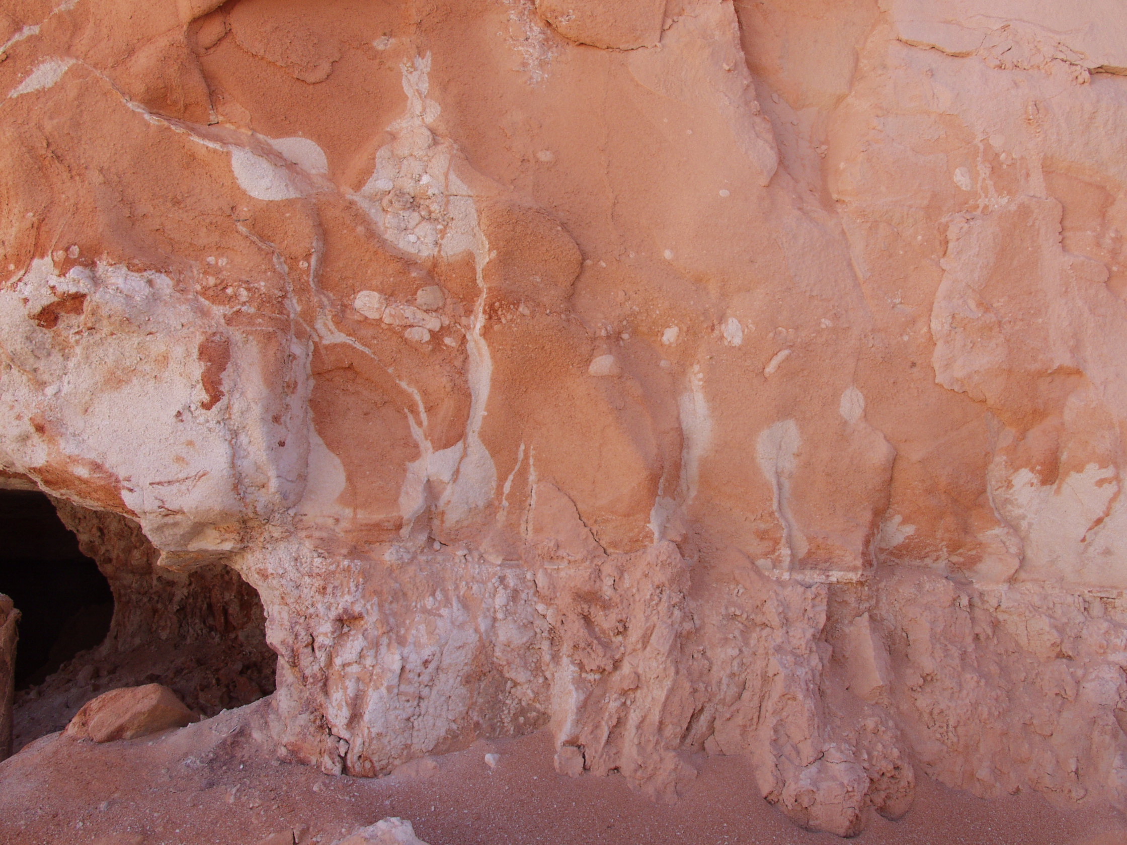
Opal is found at shallow depths in the deeply weathered portion of the Early Cretaceous Griman Creek Formation as a part of the Rolling Downs Group. These sediments out crop as low ridges on average between 15 and 20 metres above the general level of the surrounding flat black soil plains.
Opal occurs as horizontal seams, nodules (colloquially “nobbies”), and as replacements and cast fillings after fossils. Opal commonly occurs within the upper parts of the Finch clay facies lenses. The claystone lenses are referred to by miners as “levels” and the claystone itself as “opal dirt”.

A edited portion of the Geological map 1:250,000 (Angeldool 2011 2nd edition) NSW Geological Survey. Area covers the Lightning Ridge town and outer lying fields,. Green areas are the Cretaceous Griman Creek formation (Krg) that represents the rocks in which precious opal is found. The light orange areas represent the Tertiary age gravels overlying the Krg. Lightning Ridge Town is in the area top right of the map. The shape of the “Ridge” can be related to the google earth map above.

An earlier edited portion of Geological map 1:250,000 Angeldool sheet 1968 1st edition, which outlines the Rolling Downs group (in Green). The Rolling downs group contains the Griman Creek Formation , mentioned in the map on the left. The area here shows the shape of the Lightning Ridge area (middle right). The Castlereagh highway can be seen running from the lower right diagonally to the top left. This aspect gives an enlarged area that may be considered as “The Ridge”.

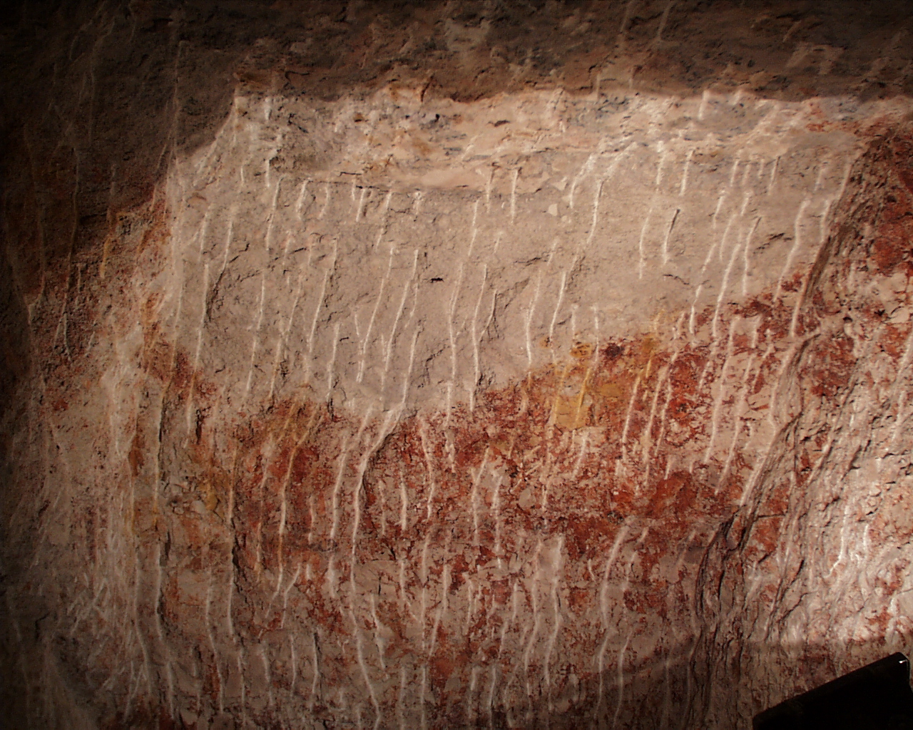
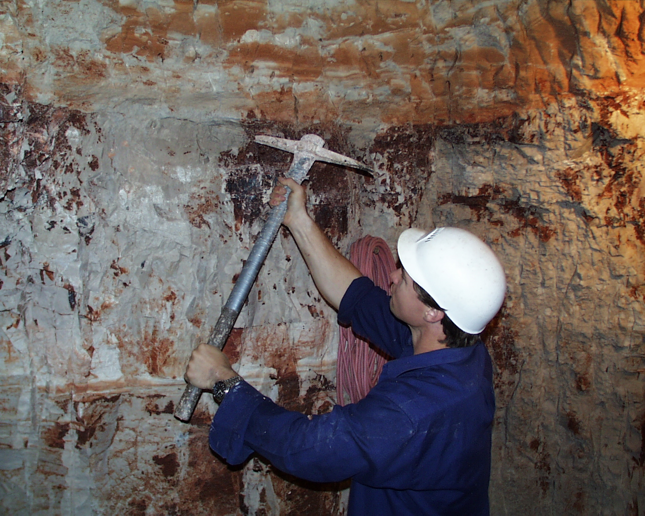
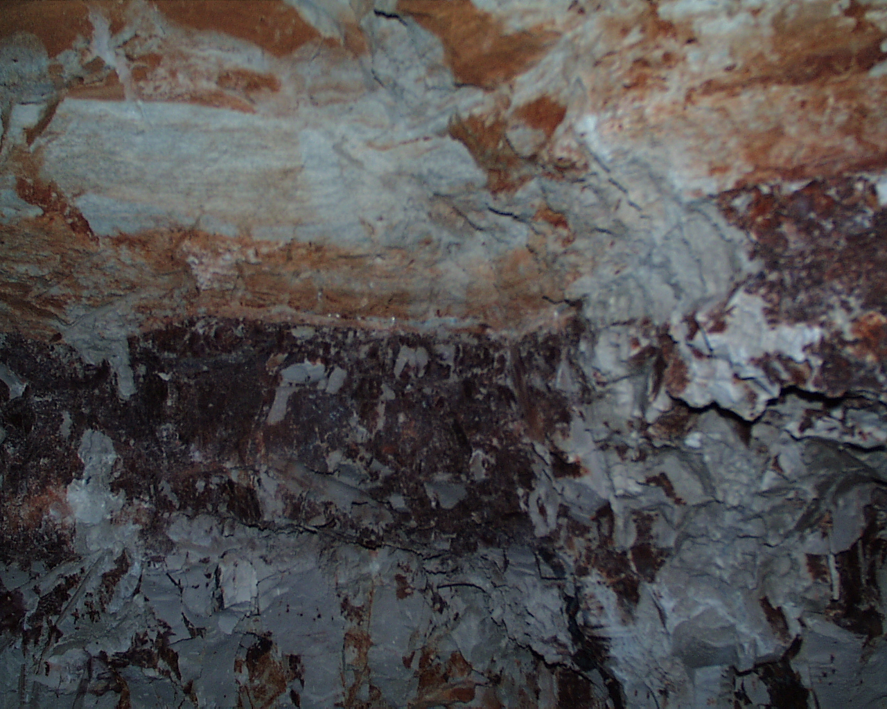
The Lightning Ridge weathered profile at Lunatic Hill. The photo shows the Lightning Ridge group (Whiting and Relph, 1961). The Upper Griman Creek formation. top unit is the Coocoran Claystone member, overlying the Wallangulla Sandstone Member (middle), the lower part of the photograph shows a lens of the Finch Clay Facies. Note that the mining has occurred at the junction “opal level” of the Wallangulla Sandstone Member and the Finch Clay Facies.
types and varieties of opal
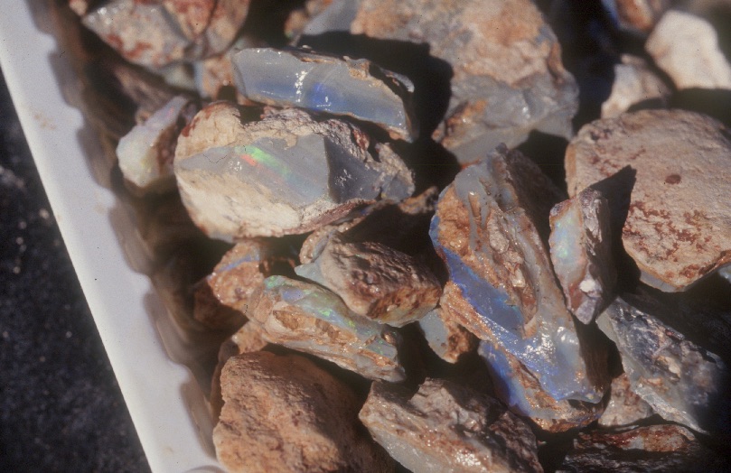
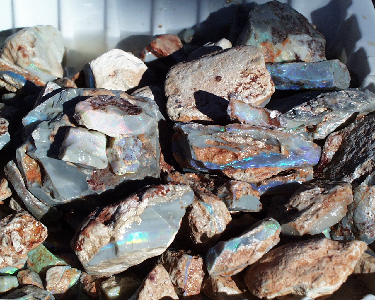
Opal and precious opal “rough” is found in Lightning Ridge as nodules often referred to by the miners and industry as “Nobbies” as well as opal in horizontal seams, “Seam opal”.

Lightning Ridge opal nobbies. A collection of dark (grey) and black opal potch nobbies.

Honey Potch nobbies. Some Lightning Ridge opal nobbies have a yellowish tinge to a more translucent body, these are commonly called “honey potch.

Chinaman’s hat nobbies are nobbies with striations and a pointed top that look like a :Chinama,s Hat”.

Samples of seam opal

Opal nobbies
Cut and polished precious opal from Lightning Ridge comes in a number of different varieties. The most prized precious opal is Black opal cut usually in normal lapidary shapes of ovals and pear shapes. Precious opal from Lightning Ridge is also carved into more free form shapes.

The Crimson Rosella a named precious black opal mined in Lightning Ridge. The opal is a long oval cabochon showing a extremely bright red predominant multi-coloured play of colour with a full faced random pattern which is very slightly inconsistent in the arrangement of the colour grains (patches). A superb gemstone.
Photo courtesy of Cody Opal

An exceptional and vibrant pear shaped cabochon precious black opal sowing a green multi-coloured consistent play-of-colour
Specimen courtesy of Colleague Rebel Black, and Photo by A. Smallwood

A free form opal step carving showing a vibrant green on blue play-of-colour and incorporating a carved section to the black potch level of this seam opal. Note the round black ‘hole” carved to remove a deep sand spot, however adding to the overall presentation of the carving.

An exceptional black opal abstract opal carving showing a vibrant green on blue random pattern designed and cut so as to preserve precious opal that otherwise may have been lost if cut into standard “oval” cabochon opal pieces.
mining techniques
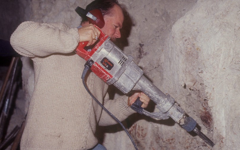
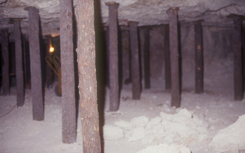
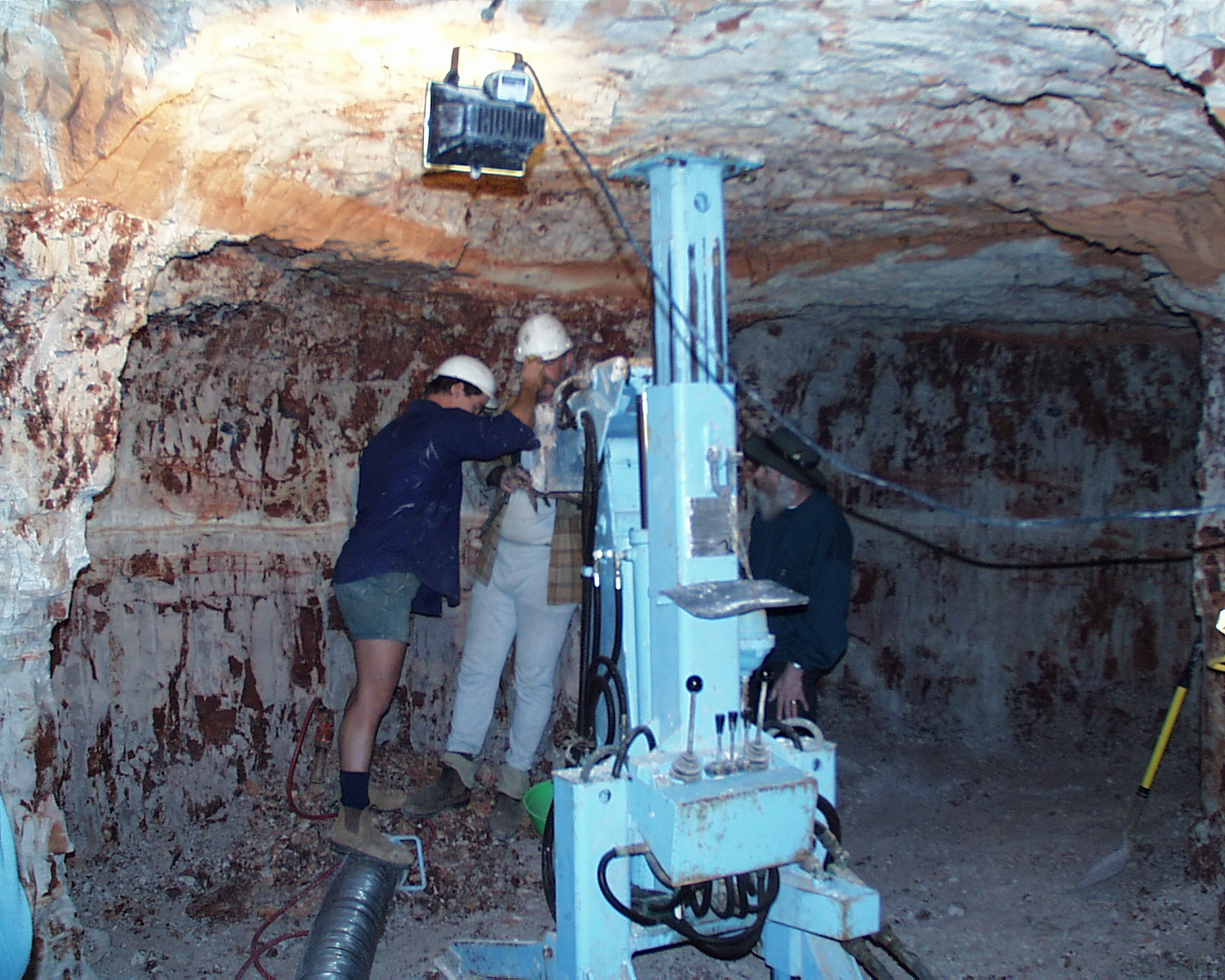
In many ways, the mining of precious opal in Lightning Ridge has developed around the specific needs of the opal miner. There are different groups of small miners or what are becoming known as artisanal miners. These can range from from one or two man partnerships through to larger groups. Mining is also done by smaller companies. The photos included below show a representative of some mining techniques used in Lightning Ridge. The reader is directed to other blog posts on the Australian mining techniques here:.

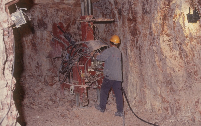
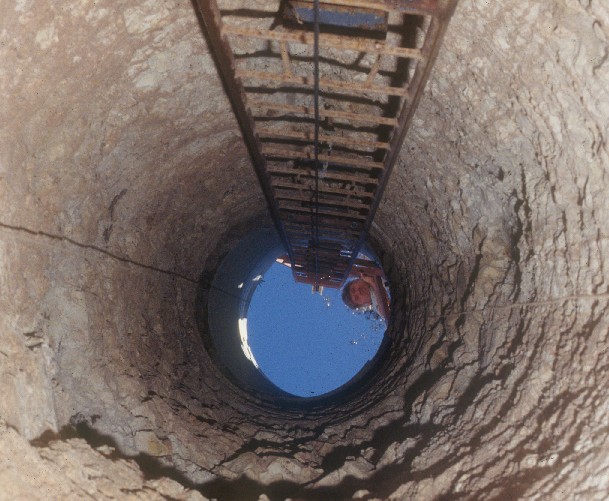
Calweld drilling rig for drilling a three foot hole for access to the opal level.

Using a 9 inch prospecting Auger to drill an opal prospecting hole at claim in he Coocoran fields at Lightning Ridge.

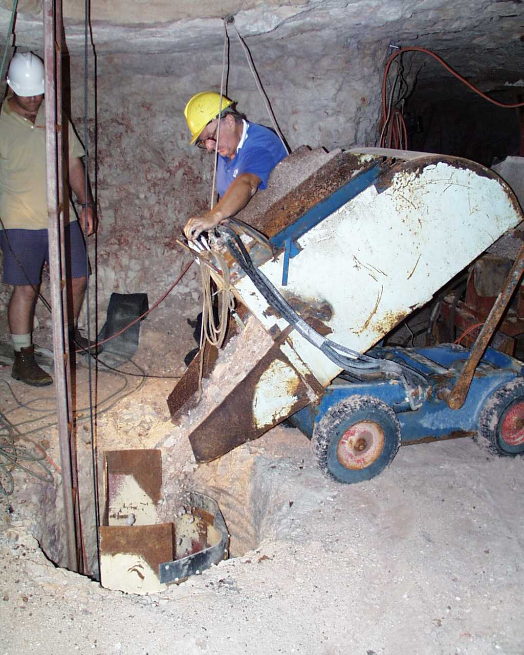
Using a modern underground digger to move the opal dirt. Note the pipe on the lower left where the dirt is funnelled in to a pipe to be uploaded by a ‘blower”

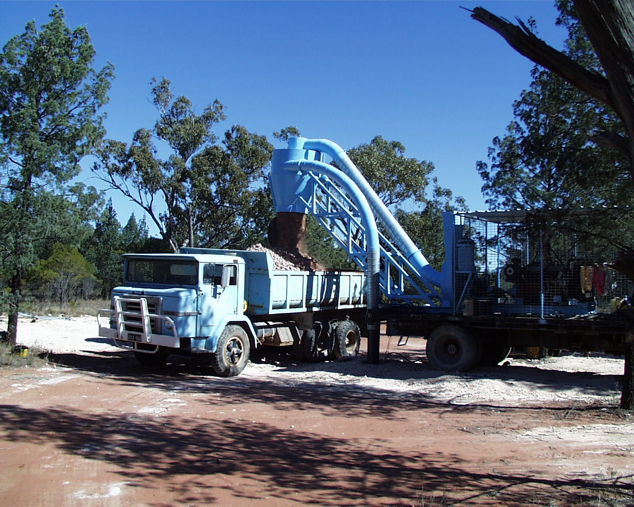
Loading the opal dirt which has been vacuumed up from the mine below and loaded onto a truck for transportation to the puddling tank for processing.

The opal dirt is loaded via conveyor to be washed in an ‘agitator’ at the puddling tank . Washing the opal dirt can take several hours or longer in order to breakdown the dirt and release the opal for further examination.

After the opal dirt, the operation of the agitator (colloquially ‘Agie’) is reversed and the process of “tailing out” is made.
life on the opal fields in lightning ridge
Living on the opal fields in Lightning Ridge is a combination of a number of tenements and differing landholding situations The town centre has what we might determine as normal household dwellings. Surrounding the town centre are “old” residential opal “Claims” preserved as old tenements. On these old time areas many people live in dwellings known as “Camps”, and these are preserved in the local council descriptions.

A ‘Camp’ at Lightning ridge

An older style dwelling at Lightning Ridge. This is typical of the ‘older’ historical days in Lightning Ridge.
outerlying opal fields associated with the lightning ridge district
Within the geographical are of “Lightning Ridge” are other gemstone fields that have become separate to the Ridge in their own right. These opal fields are named as the “Grawin”, Glengarry, and the Sheepyards, the there are other areas which are a distance from Lightning Ridge Town supporting opal mining which have not become a “town” entity also as discussed above are the fields known as “the Coocoran” and a part of a rush that occurred, in opal mining.
some selected literature
geological literature
Whiting, J.W. and Relph, R.E. (1958), The Occurrence of Opal at Lightning Ridge and Grawin, with Geological Notes on County Finch. Dept. Mines NSW. You can read the report here:
Watkins, J.J. (1984), Future Prospects for Opal Mining in the Lightning Ridge Region. NSW Department of Mineral Resources. You can read this report here:
Explanatory Notes, Angledool 1:250,000 Geology Sheet SH/55-7 NSW Dept. Resources and Energy, Geological Survey of NSW, (2011)
History
Idriess, Ion.L., Lightning Ridge. The land of Black Opals (1940) Angus and Robertson, Sydney.
Idriess, Ion.L.,, Opals and Sapphires. (1967). Angus and Robertson, Sydney.
Pritchard, Katherine Suzannah, (1946) Carlson House, Sydney.
other literature
Stuart Lloyd, (1967) The Lightning Ridge Book., South China Morning Post, Ltd.
Les Taylor, (1985)., Struck by Lightning, Jon the printer Pty Ltd, Ashmore , Queensland.
Di Morrissey, (2011)., The Opal Desert. Pan McMillan Australia Pty. Ltd.
tourism and visiting the ridge

The Logo of the Australian Opal Centre

The Lightning Ridge bore baths in the evening, Hot therapeutic natural water from the Great Artesian Basin, a must visit for “The Ridge”. Photo courtesy of the Lightning Ridge Tourism Association.
You can find out more about attraction sin Lightning Ridge by visiting the following link: https://www.explorelightningridge.com.au/Things-To-Do/Arts-Culture-History/Heritage-Walk-Lightning-Ridge
Lightning Ridge is a vibrant, educational and immersive tourist destination for all those who are travelling in outback NSW. Lightning Ridge offers numerous attractions including opal field and mine tours, opal retail shops, The Australian Opal Centre not for profit museum, free artesian baths, art gallery, quirky attractions, and much more. Plenty of accommodation options to suit all styles, dining options and the all important fuel facilities. During the year there are two major festivals – Easter weekend which is packed full of family fun and entertainment and Opal Festival (last week each July) where opal from all over Australia is showcased across various venues.
Care needs to be taken though, as touring the opal fields has some limitations, and this is best done by using the commercial tours available to all or the variously coloured car door tours (map available from the Visitors Information Centre). Always remember that the opal fields are working mining areas, and that “opal claims” are private property with legal restrictions. Always enquire where you can visit without trespassing. Never assume that a mound of mullock on the side of an access road can be fossicked through – it is most likely on someone’s registered claim. Ask at the Visitors Information Centre where one can fossick for opal.

The welcome sign driving into “The Ridge”. Some people will always say that the population of Lightning Ridge may be transient, perhaps we don’t know how many people call the town home?

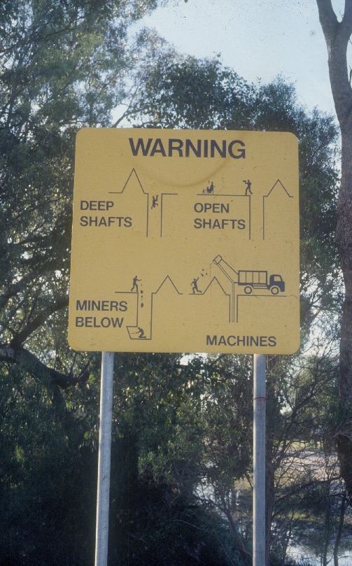
Lightning Ridge is a mining town as well as a tourism haven. When visiting please always include safety whilst visiting, there are some dangers please tread carefully.

A mineral claim, or opal mining lease is private property. More information for the tourist is that where there are mining leases, the ground or property is private land to the claim holder. If visiting please respect these claims.

Touring the opal fields is easy, just follow the “Car door” opal trails!
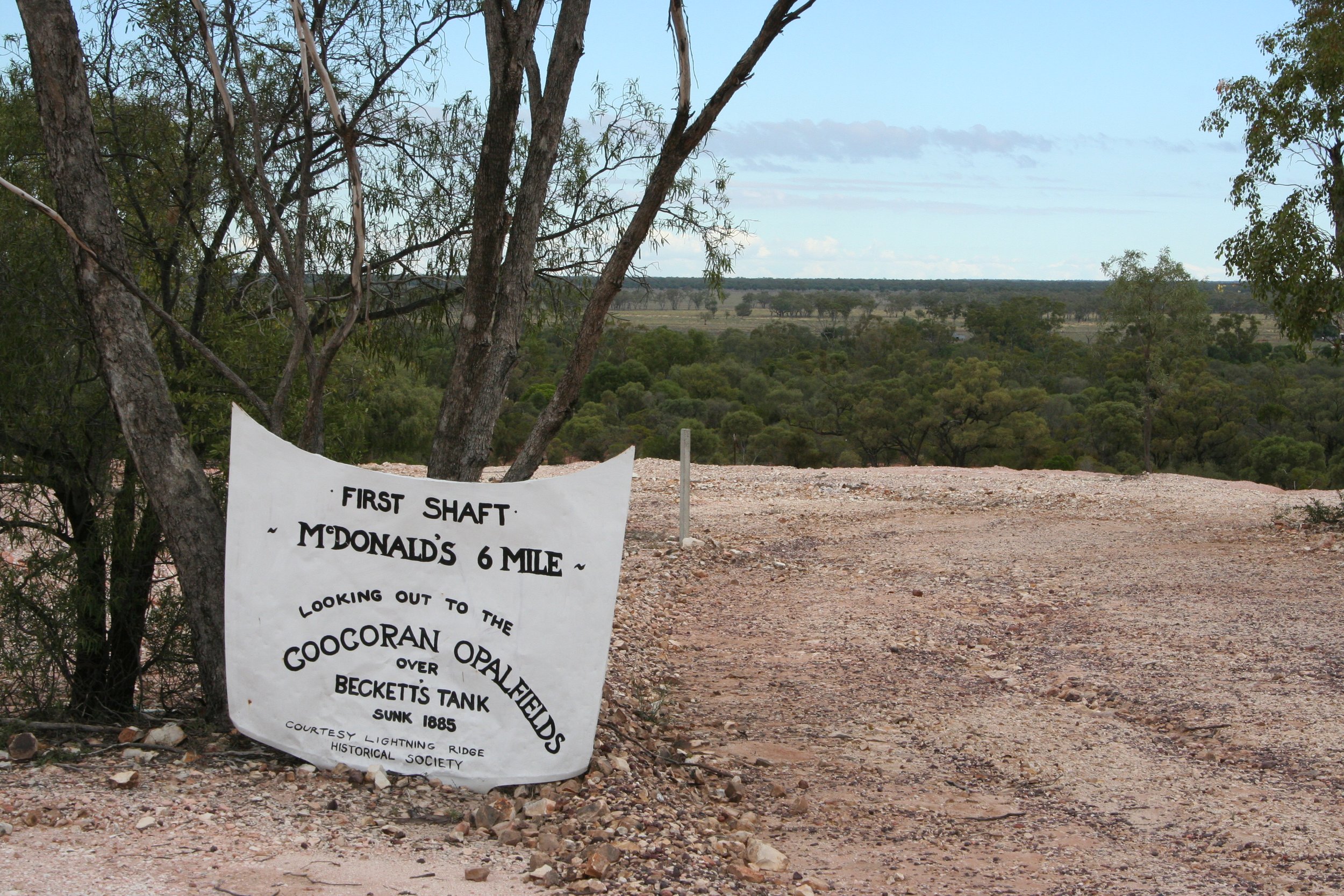
Just follow the “car parts” A view here from “Six Mile” field looking west towards the outer lying opal fields of Coocoran.

Sunset in the opal fields from the “First Shaft” Mine shaft outlook.